“SATLINK-OV1: Operational Viewpoint Interface”
What I enjoy most about working at the principal level in motion design is creating systems rather than only outputs. Building tools like this expands capability across an entire team. it eliminates undesirable production tasks while improving consistency. Motion design at scale becomes less about producing individual graphics and more about designing the infrastructure that enables better workflow.
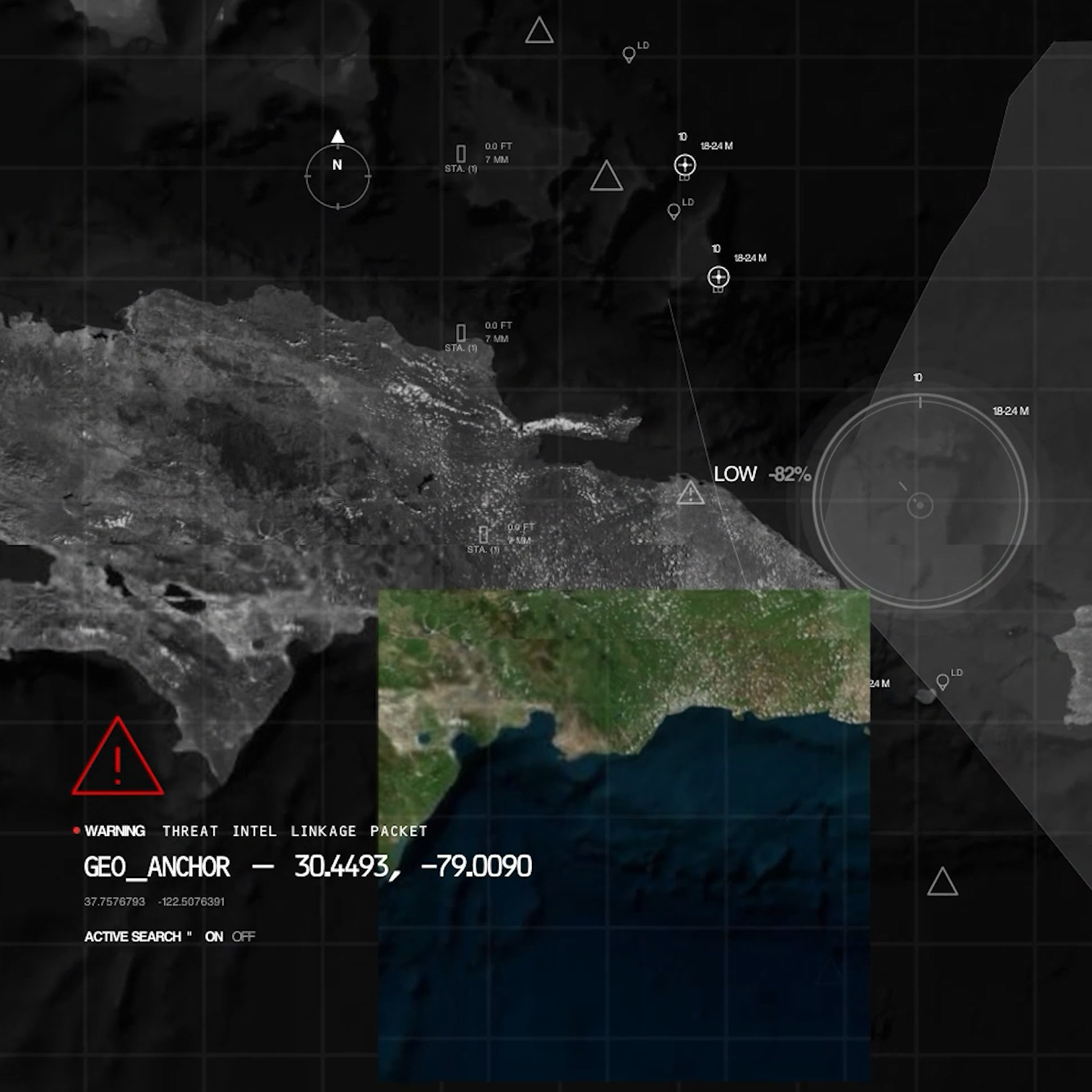
I developed an internal plugin for Adobe After Effects that transforms world map and geospatial data into a motion design workflow purpose-built for rapid scene generation. The tool allows designers to navigate a globe interface, establish waypoints, define regions of interest, and automatically generate layered compositions in multiple aspect ratios for downstream animation and delivery.
I designed to reduce friction in location-based storytelling and information visualization, the system streamlines the creation of map-driven sequences commonly used across defense media, broadcast graphics, situational awareness visuals, and technical communication environments. Rather than manually rebuilding geographic scenes for every deliverable format, designers can quickly establish a geographic narrative framework and generate composition-ready assets directly inside After Effects.